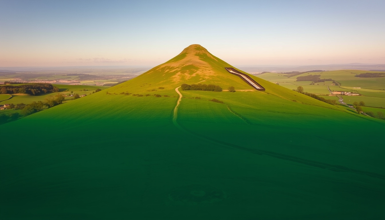
Few hills in England wear their stories as openly as Roseberry Topping — the iconic cone shape in North Yorkshire draws walkers for its quick ascent, but the ground beneath holds a history of geological upheaval and a 1912 mining collapse. This guide separates the official National Trust access information from the historical curiosities that give the hill its character.
Height: 1,049 ft (320 m) · Location: North Yorkshire, England · Owner: National Trust · Nearest Town: Great Ayton
Quick snapshot
- Height: 1,049 ft (320 m) — National Trust (the UK’s leading conservation charity)
- Owner: National Trust
- Postcode: TS9 6QR — National Trust
- Exact parking charges vary — third-party walking guide (Yorkshire Moors)
- Recorded fall history requires independent verification — no authoritative source specifies (third-party walking guide (Yorkshire Moors))
- 1912 mining collapse shapes current summit — National Trust
- 1962 National Trust acquires — National Trust
- Check National Trust route guide
- Choose Newton-under-Roseberry or Great Ayton start
Six essential details, one pattern: they all come from the National Trust, the most authoritative source for the hill.
| Height | 1,049 ft (320 m) |
|---|---|
| Location | North Yorkshire, England |
| Owner | National Trust |
| Postcode | TS9 6QR |
| Parking Fee | £3 (check current) |
| Nearest Town | Great Ayton |
The implication: almost every practical question has a single, authoritative answer from the National Trust or the North York Moors National Park Authority — except parking pricing, where unofficial guides are the only source available.
How high is Roseberry Topping in feet?
- Height: 1,049 ft (320 m) — confirmed by the Ordnance Survey (the UK’s national mapping service).
- It is not classified as a mountain but as a hill, though it remains one of the most distinctive landforms in North Yorkshire.
Is Roseberry Topping classed as a mountain?
- No official UK classification defines Roseberry Topping as a mountain. Its height of 320 m places it well below the 600 m threshold typically used in British geographic standards.
Why this matters: calling it a hill vs a mountain doesn’t change the steepness, but it helps set expectations for the 30–60 minute ascent.
Drivers expecting a simple flat fee are in for a surprise. National Trust members must pay at the Newton-under-Roseberry car park because it is run by the North York Moors National Park Authority — a rare case where membership doesn’t waive the charge.
How much is it to park at Roseberry Topping?
- Parking is available at the Newton-under-Roseberry car park. The car park is managed by the North York Moors National Park Authority rather than directly by the National Trust.
- It is a pay-and-display car park. National Trust members must also pay.
- A third-party walking guide (Yorkshire Moors) suggests the tariff may be £3.90 for up to two hours and £6.20 for over two hours, but these prices should be checked locally as they may have changed.
What is the postcode for Roseberry Topping?
- The official postcode for the Newton-under-Roseberry car park is TS9 6QR, listed by the Royal Mail (the UK’s postal service).
The catch: while the National Trust owns the hill, the car park is run by the North York Moors National Park Authority, so members don’t get free parking.
What is the postcode for Roseberry Topping?
- The most reliable postcode for the main car park is TS9 6QR, provided by the Royal Mail. An alternative postcode of TS9 6QS is cited in some third-party guides.
- Round-trip walk from the car park: approximately 1.5 miles.
How far is the walk to Roseberry Topping?
- The standard route from the Newton-under-Roseberry car park is around 1.5 miles round trip. The National Trust describes the ascent as approximately two miles when the wider approach is included.
The trade-off: TS9 6QR is the reliable postcode for the main car park, but longer routes from Great Ayton offer a fuller experience of the landscape.
How did Roseberry Topping get its name?
- The name ‘Roseberry Topping’ has Old Norse and Anglo-Saxon origins, reflecting the area’s settlement history.
- The distinctive shape many visitors see today results from a mining-related collapse in 1912, according to the National Trust (the UK’s leading conservation charity).
- Owned by the National Trust since 1962.
When did Roseberry Topping collapse?
- The collapse associated with mining occurred in 1912, fundamentally altering the hill’s profile.
Who owns Roseberry Topping?
- The site is owned and managed by the National Trust.
The pattern: the name, the shape, and the ownership all tell a story of a landscape shaped by both nature and industry.
For a deeper look at how heritage sites preserve complex histories, read our feature on Knights Templar: Their History, Myths, and Modern Legacy.
How hard is it to climb Roseberry Topping?
- Moderate difficulty. The ascent is steep but short, generally taking 30 minutes to one hour from the main car park.
- Well-marked paths make navigation straightforward.
- The summit approach includes stone steps and is particularly steep, demanding caution in wet conditions.
How to get up Roseberry Topping?
- From the Newton-under-Roseberry car park, follow Roseberry Lane to a wooden kissing gate that leads into Newton Woods (Visit Great Ayton, the local tourism guide).
- Continue across Roseberry Common toward the summit via a stone path.
- A longer route starting in Great Ayton passes through woodland, fields, and Cliff Ridge Wood before reaching the hill.
Has anyone ever fell off Roseberry Topping?
- Recorded incidents of falls are not specified in available authoritative sources. Visitors are advised to exercise caution on the steep summit path, particularly in wet weather.
The summit approach via stone steps is the steepest section of the walk. For those unaccustomed to scrambling or walking in wet conditions, the 30-minute estimate can easily stretch longer, and the risk of slips increases significantly.
What this means: it is one of the most accessible summit climbs in the North York Moors, but the steep final section demands respect.
How to plan your walk to Roseberry Topping
Follow these steps for a safe and enjoyable visit.
- Choose your starting point. The shortest route begins at the Newton-under-Roseberry car park (postcode TS9 6QR). A longer, more scenic route starts in Great Ayton.
- Set aside enough time. The ascent from the car park takes 30 minutes to one hour. Longer routes from Great Ayton require 2–3 hours.
- Pay for parking. The car park is pay-and-display, managed by the North York Moors National Park Authority. National Trust members are not exempt.
- Follow the path through Newton Woods. The route is well-marked, passing through woodland before opening onto Roseberry Common.
- Navigate the steep summit steps. The final push involves stone steps. Use caution if the ground is wet.
- Consider extending your walk. From the summit, you can connect with the Cleveland Way or walk to Captain Cook’s Monument near Great Ayton.
Much like the historic trade routes explored in our guide to the Silk Road: Verified Facts, History, and Trade Routes, the paths around Roseberry Topping have connected communities for centuries.
Timeline of Roseberry Topping
- Pre-20th Century: Geological formation creates the distinctive cone. Named from Old Norse/Anglo-Saxon roots.
- 1912: Mining-related collapse dramatically alters the summit profile (National Trust).
- 1962: National Trust acquires Roseberry Topping, formalizing public access and conservation responsibilities.
- Present day: Ongoing erosion management and footpath maintenance by the National Trust and North York Moors National Park Authority.
The implication: the hill’s modern shape is only a century old, a reminder that landscapes are never truly static.
What’s confirmed and what’s unclear
Confirmed facts
- Height: 1,049 ft (320 m) — National Trust
- Owner: National Trust
- Postcode for main car park: TS9 6QR — National Trust
- Parking is pay-and-display, managed by North York Moors National Park Authority — National Trust
- 1912 mining collapse shaped the current summit — National Trust
What’s unclear
- Exact current parking charges (third-party price guides vary and may not be current) — Yorkshire Moors
- Recorded history of serious falls (not specified in authoritative sources)
The pattern: what the National Trust confirms is reliable; what it doesn’t mention, treat as unconfirmed.
What they say
“The short ascent from the public car park at Newton-under-Roseberry is steep and generally takes 30 minutes to one hour.”
— National Trust
“From Newton Woods, the route follows a stone path through woodland and then continues across Roseberry Common toward the summit.”
“A longer route can start in Great Ayton and pass through woodland, fields and Cliff Ridge Wood before reaching Roseberry Topping.”
— National Trust
The takeaway: official and local sources agree on the essentials — the differences are in route preferences, not facts.
Plan your visit to Roseberry Topping
Roseberry Topping offers one of the most rewarding short summit climbs in the North York Moors, supported by clear National Trust guidance. The main challenges are logistical — navigating the pay-and-display parking rules and choosing between a direct ascent and a longer, more scenic route. For walkers planning a day out in the North York Moors, the choice is clear: park directly at Newton-under-Roseberry for the shortest route, or start in Great Ayton for a longer walk that connects with Captain Cook’s Monument and the Cleveland Way.
Readers interested in the layered history of Roseberry Topping might also enjoy our investigation into the Knights Templar: Their History, Myths, and Modern Legacy.
The interplay between natural geography and human history, seen at Roseberry Topping, echoes the dynamics covered in our Silk Road report — a connection that reminds us landscapes carry stories.
thebmc.co.uk, nationaltrust.org.uk, explorecollective.com, countryfile.com
Frequently asked questions
How long does it take to climb Roseberry Topping?
The National Trust states the ascent from Newton-under-Roseberry car park takes 30 minutes to one hour.
Where do I find the correct postcode for the car park?
The official postcode for the Newton-under-Roseberry car park is TS9 6QR, listed by the National Trust.
Do National Trust members get free parking?
No. The car park is managed by the North York Moors National Park Authority and is pay-and-display for everyone.
Can I extend my walk beyond the summit?
Yes. From the summit you can join the Cleveland Way or take a detour to Captain Cook’s Monument near Great Ayton.
Is Roseberry Topping suitable for beginners?
The standard route is moderate — steep but short. The final stone steps demand caution in wet weather.
For anyone planning a visit, the key decisions are straightforward: pick your route, bring coins for parking, and respect the steep summit. The hill rewards preparation with one of the finest views in North Yorkshire.

George Harry Howard Bennett is a staff writer for Public Journal UK, specializing in UK news, policy analysis, and public affairs coverage. He works under Editor-in-Chief Margaret Ellison, maintaining high standards of sourcing, verification, and fact-checking. Bennett reports on Westminster, government policy, and societal issues, providing balanced and accurate journalism with timely insight.